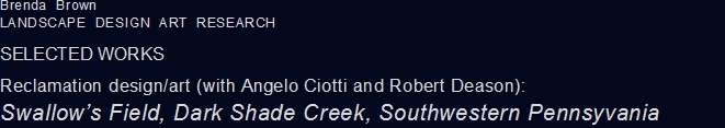
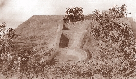
Swallow's Field, so-called for its owner,
Curtis Swallow, lies at the headwaters of Dark Shade Creek (see
existing conditions above). It is one of over 30 sites in
the watershed where acid-mine discharges (AMD) occur.
Because of its location, Swallow's Field is to be one of
the first places in the watershed where contaminated discharges
will be treated.
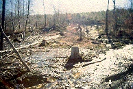
The AMD rate here is relatively small -
only one gallon per minute - but having a PH of 3.0, it is
extremely acidic. The effects of the discharge are
exacerbated by the large amount of water eroding the poorly
vegetated surface mine above. Eventually, as part of a
larger plan, that land will be planted again. However,
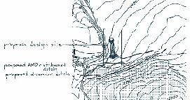
for the current project, a diversion ditch will be dug along
the north perimeter of the hill's base, thus keeping the
erosional water away from the AMD seepage area.
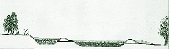
In choosing how to treat AMD water, one
considers the site and the discharge -- the elements it
carries, its load, and size. Here we start by building a
vertical flow (its bottom lined with limestone and mushroom
compost) and retention ponds and use the existing lowland as a
non-enclosed wetland. By the rime the water enters the
the wetland -- where further filtering will occur -- much
of its acidity is already removed. It will once again
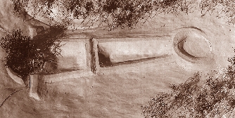
support life. The proposed design also offers features
besides AMD treatment. Its exaggerated use of linear
perspective, symmetry, round areas and geometric forms
playfully refers to the 17th century landscape architect Andre
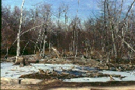
Le Notre. Here, a portion of the dead zone, its trees
killed by AMD, is maintained, even enframed. Visitors
walk around and over it and use it for a look-out from which to
view the wet woodland below. The small cypress grove that
completes the circle has a different effect.
The pool's banks invite walking and also
provide access for maintaining the pools. The pool's
forms also suggest an arrow. This "arrow"
points to the magnetic north as it was in 1753 (magnetic north
shifts over the years) when George Washington, Christopher
Gist, Jacob Vanbraam, Barnaby Currin, John McQuire, Henry
Steward and William Jenkins surveyed the area. The route
taken by these men was the foundation for Forbes' Road, which
was built in 1758, became a major passage for early westward
travel, and is the basis for the contemporary US Route 30,
which provides the major access to Swallow's field. The
reference to the surveyors and their work is made explicit by
the indications of magnetic as well as true north and the
engraved names and date in the inner circle of the look-out,
and reinforced by the vertical rod (in line with the 1753
magnetic north) at the top of the round, north-end wall.
It is further reinforced in the top-most circular area in
the south; it and its walkways are oriented toward the cardinal
directions. Thus two contrasting geometries are
juxtaposed.
Original design conceived with Angelo
Ciotti and Robert Deason. Concept and design development,
models and drawings by Brenda Brown. An AMD&ART
project, Allen Comp, AMD&ART director.